
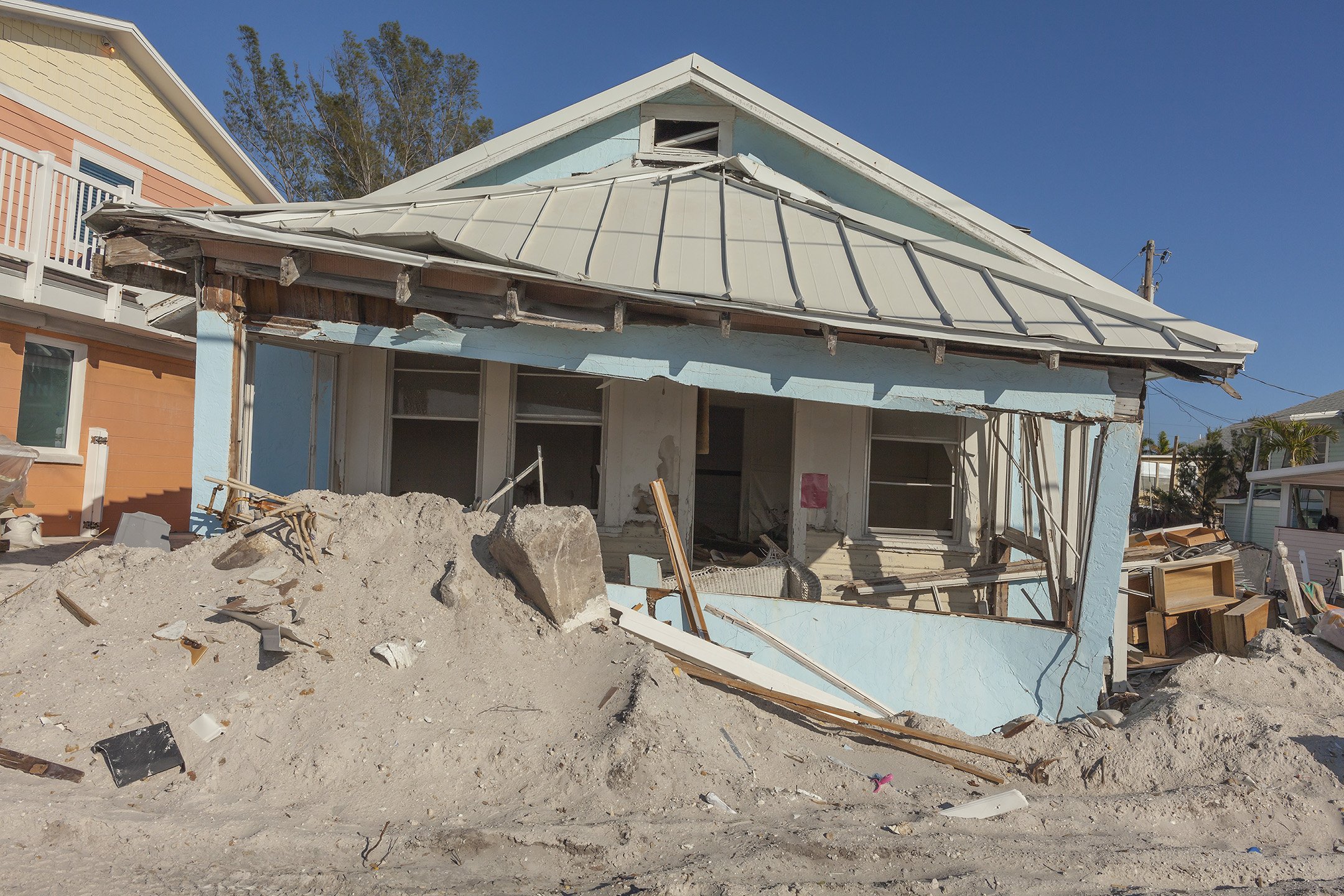
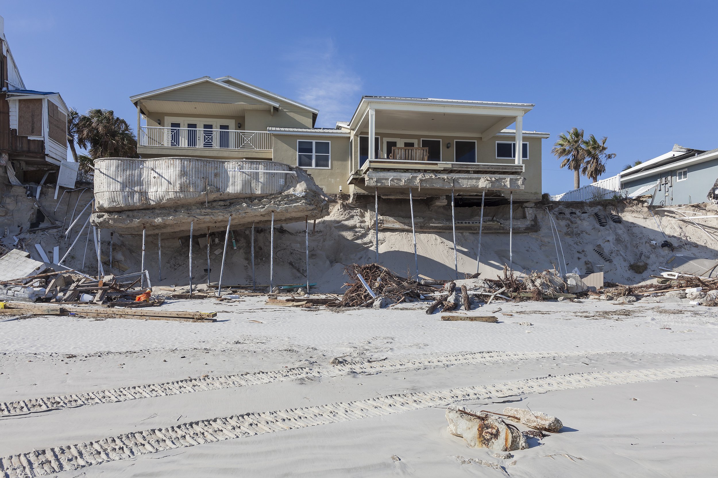
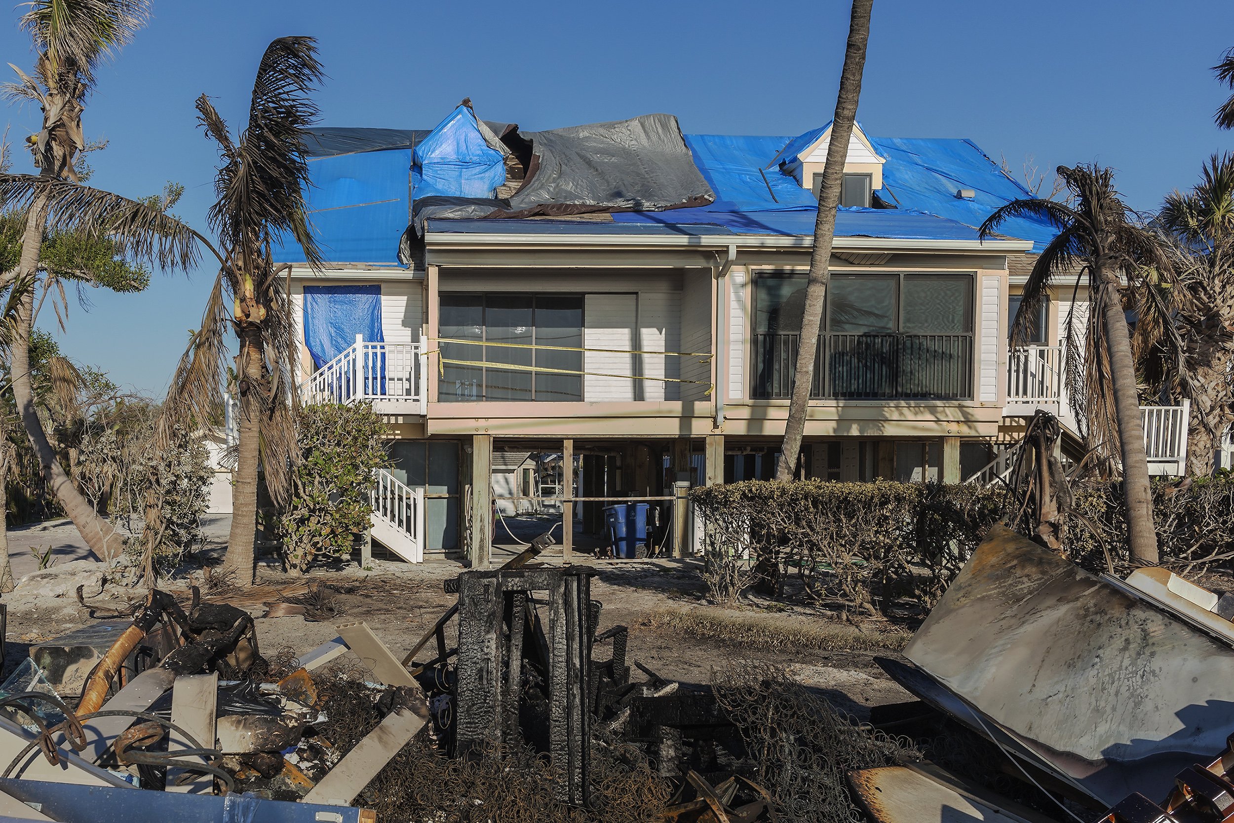
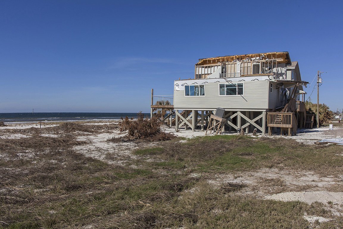
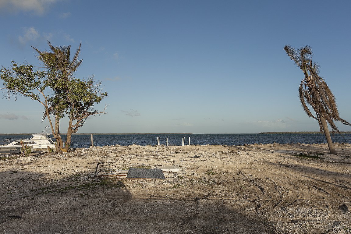
1201B Gulf Drive S. After Hurricane Milton, Bradenton Beach, Florida, 2024 N 27.4579 W 82.6961 Elevation Five Feet
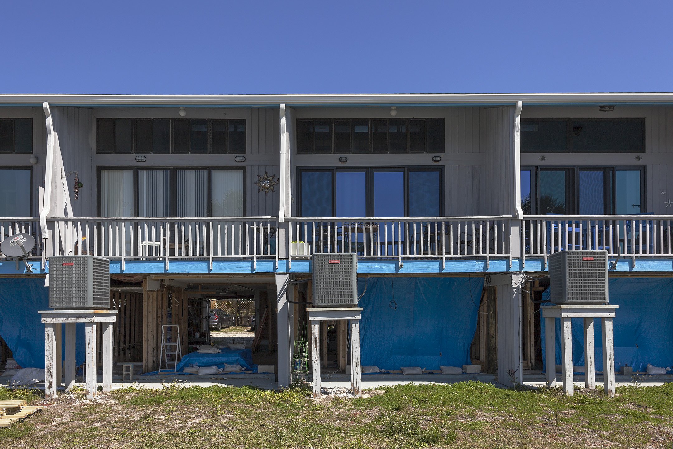
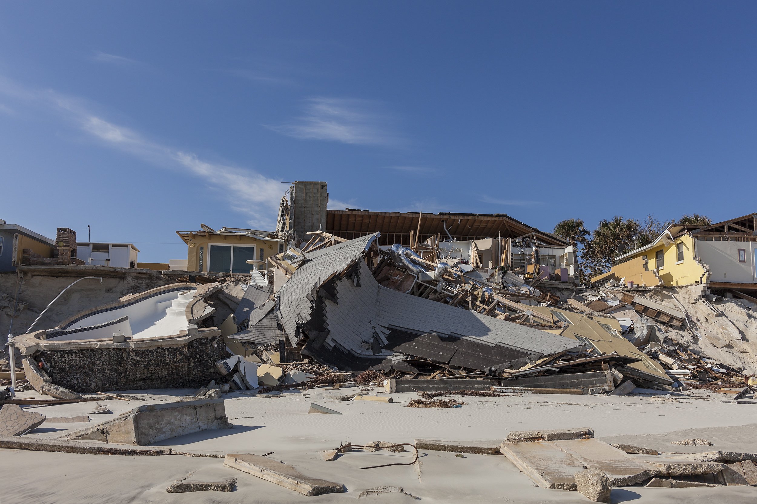
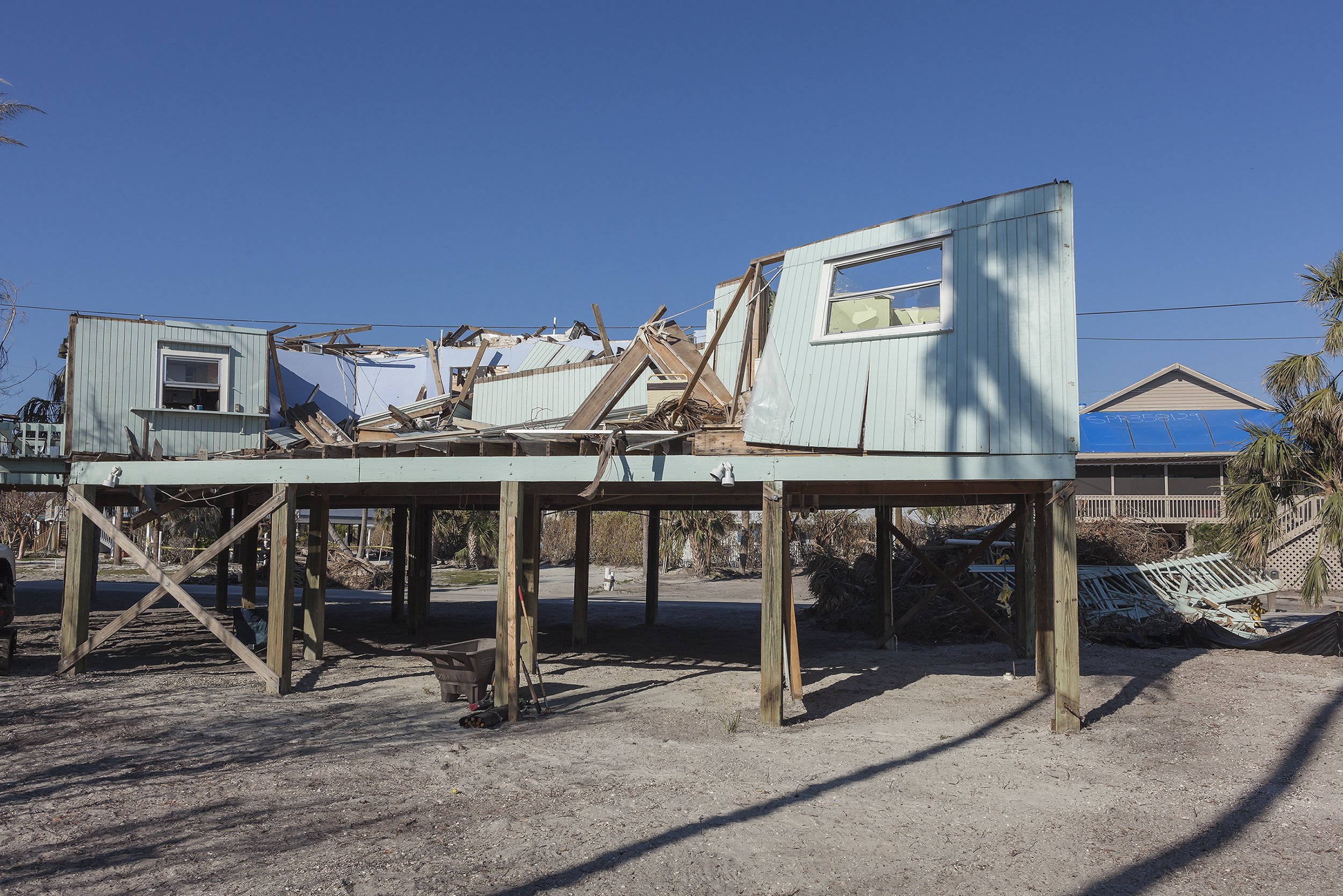
305 Gulf Drive North Totaled by Hurricane Milton, Bradenton Beach Florida, 2025 N 27.4709 W 82.7005 Elevation Three Feet
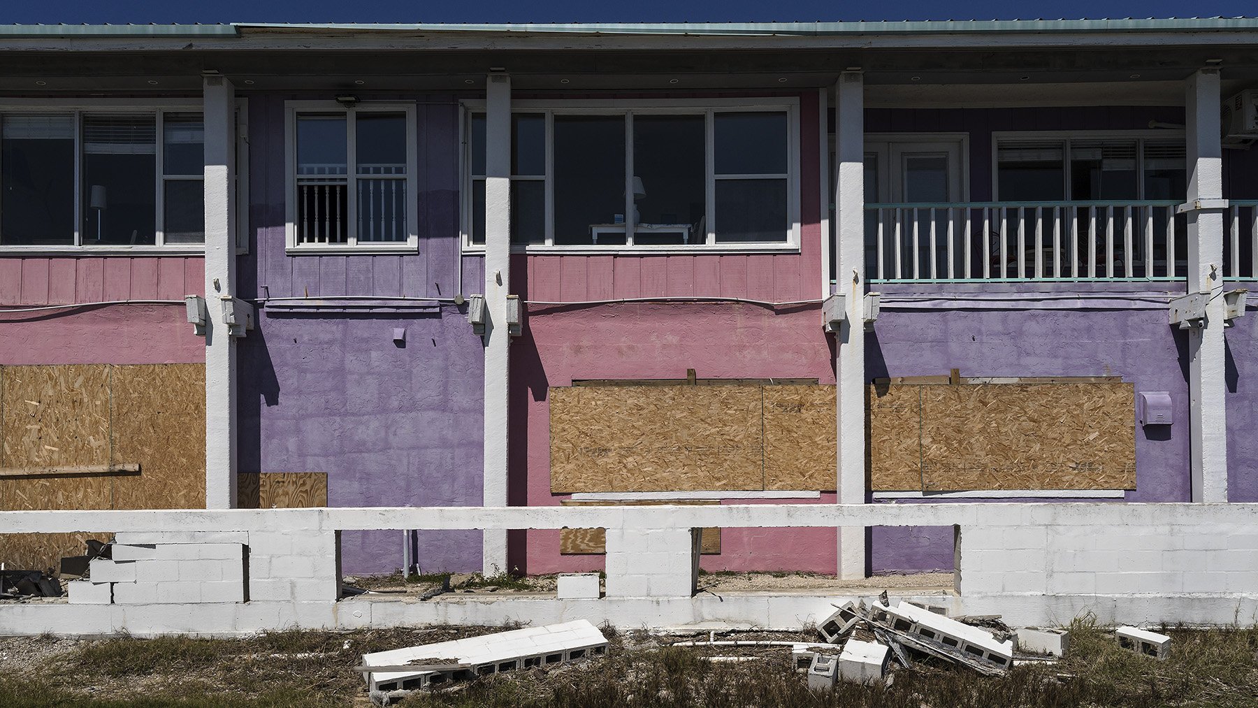
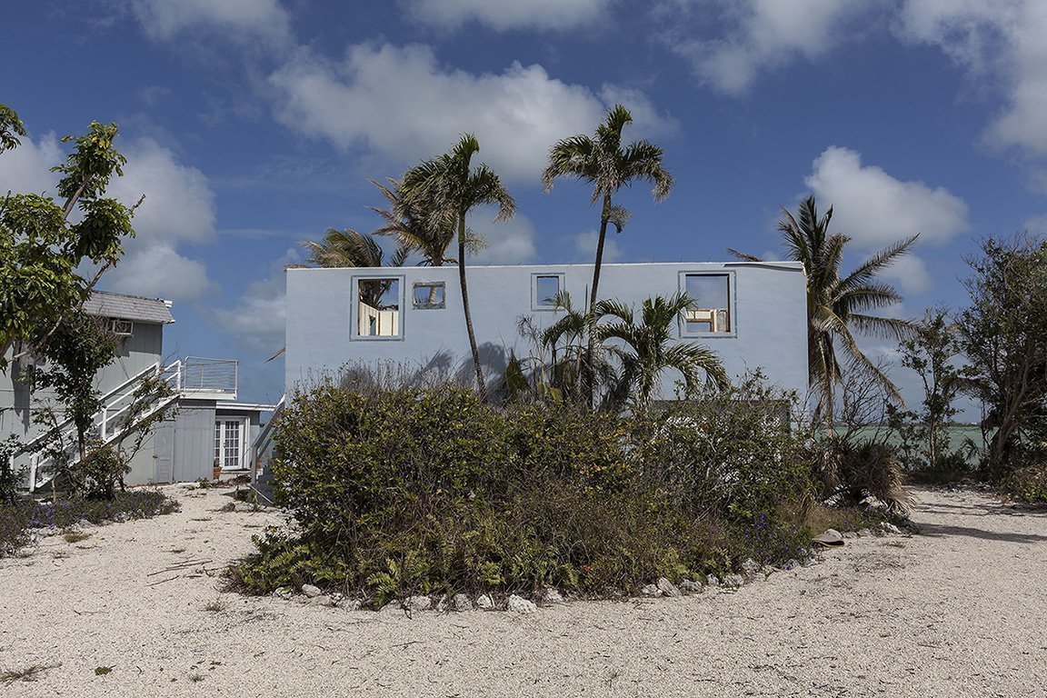
Tres Palmas Condos, Damaged by Hurricane Milton and Later by Hurricane Helene, 850 Third Street, Cedar Key, 2024 N 29.137 W 83.033 Elevation Three Feet

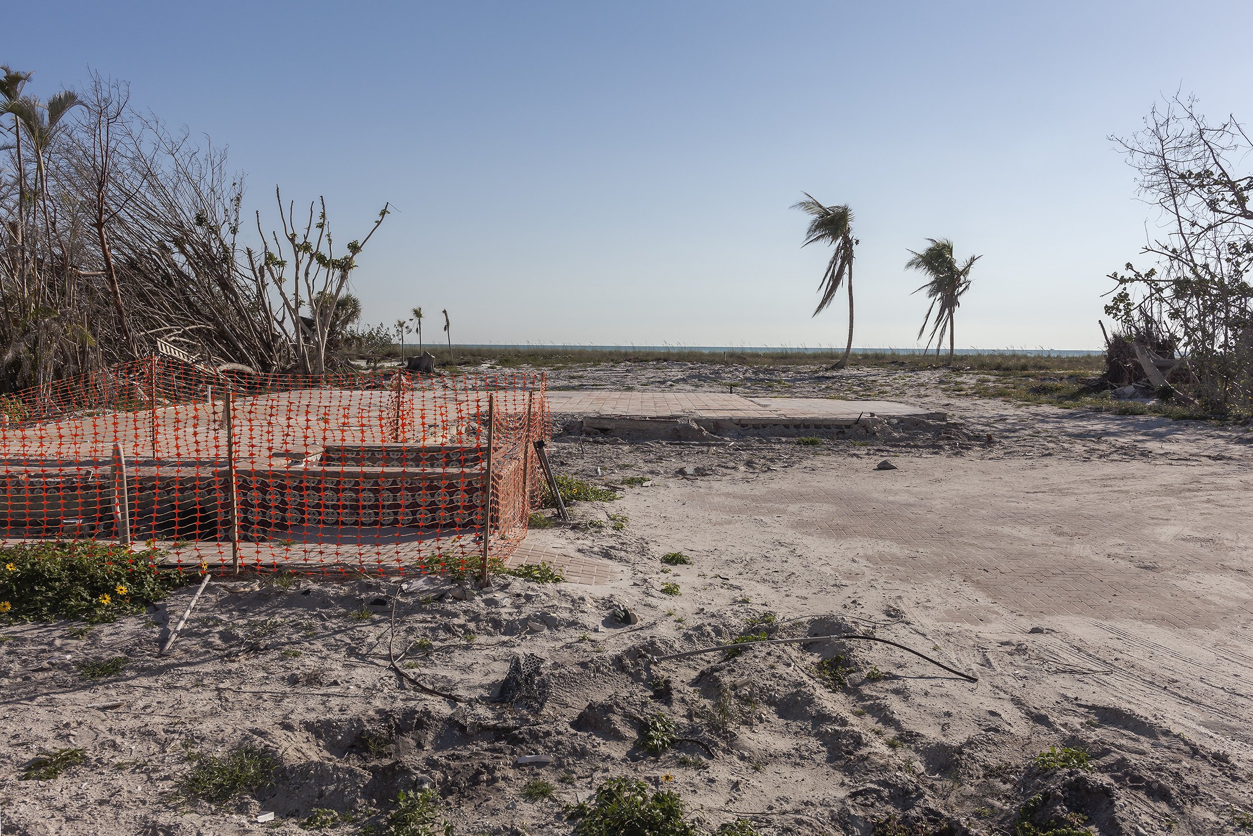
Site of a Destroyed Cottage Faraway Inn, after Hurricane Idalia, Cedar Key Florida, 2024 N 29.1359 W 83.0365 Elevation Four Feet

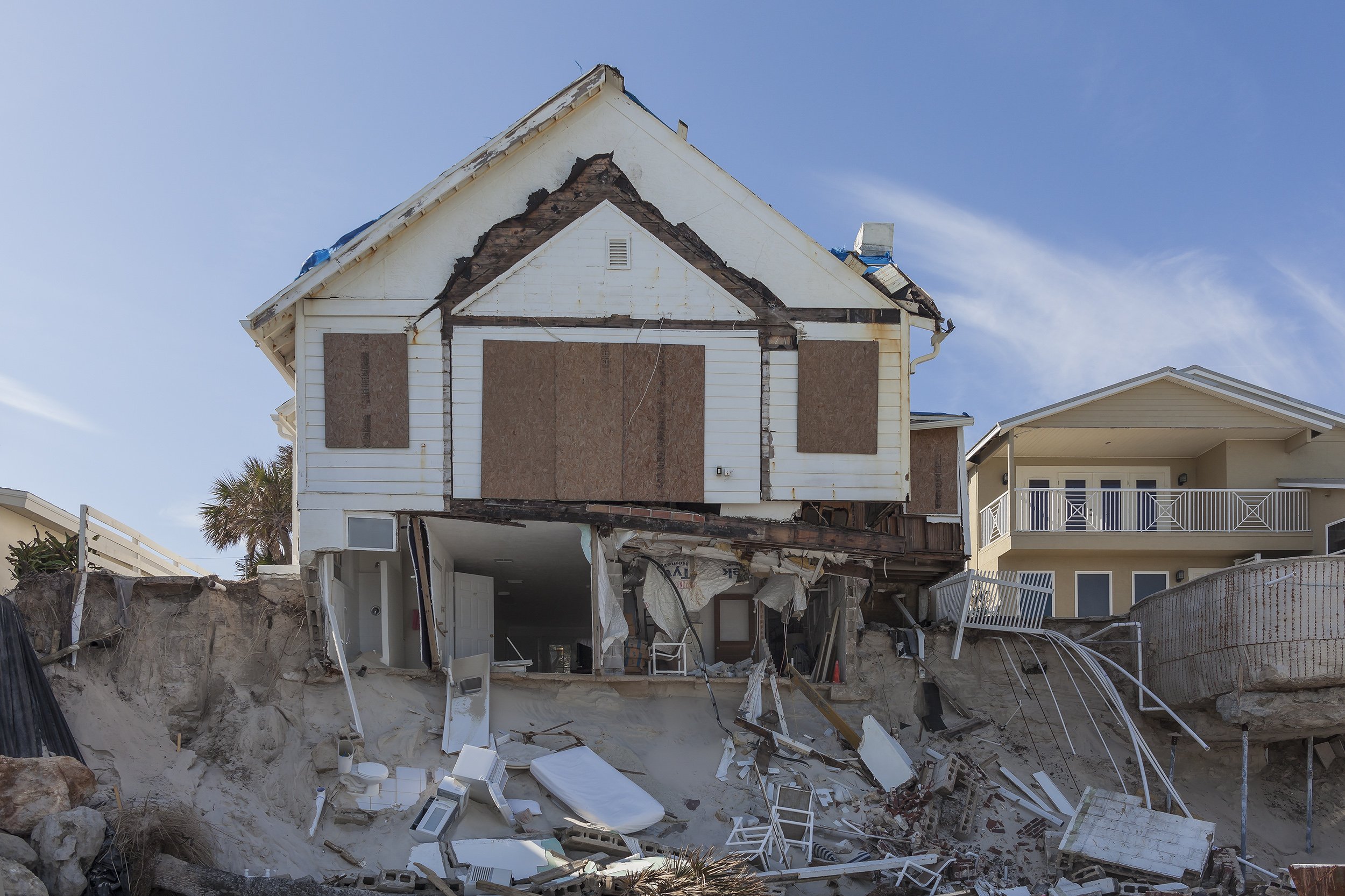
Faraway Inn, Cottage #2, Badly Damaged by Hurricane Idalia, Later Totally Destroyed by Hurricane Helene, Cedar Key, Florida 2024 N 29.1359 W 83.0364 Elevation Five Feet
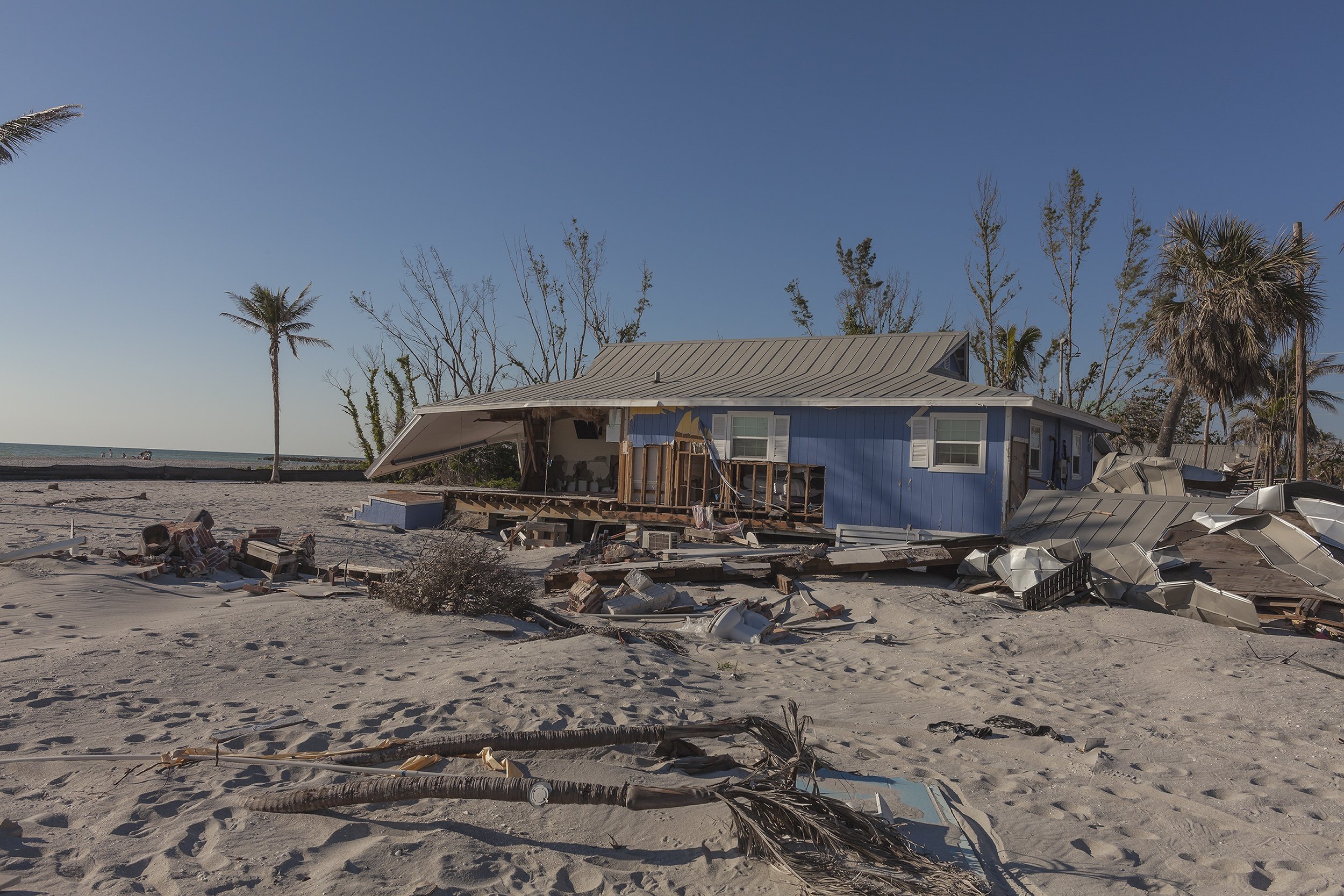
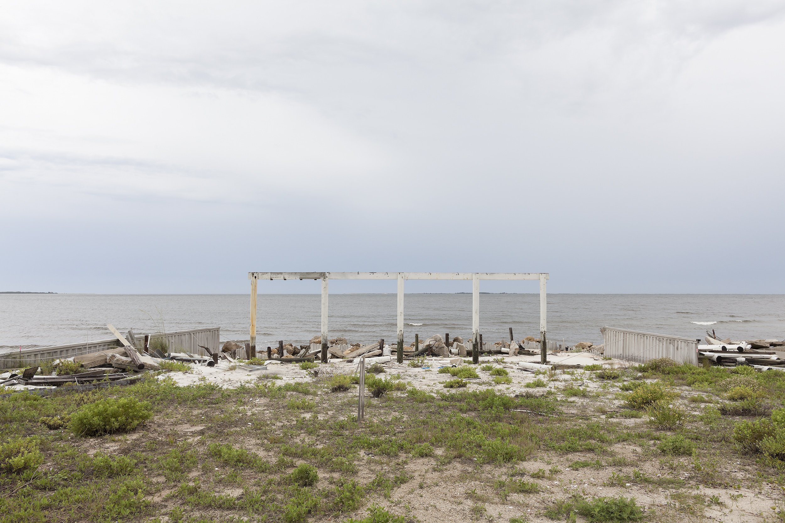
Beach Front Motel. Badly Damaged by Hurricane Idalia, Later Totally Destroyed by Hurricane Helene, Cedar Key, Florida, 2024 N 29.1343 W 83.0357 Elevation Two Feet
4121 S. Atlantic Ave. after Hurricane Nicole, Wilbur By The Sea, Daytona Beach Shores, Florida 2023 Elevation 20 Feet. N 29.12915 W 80.95817
4119 S. Atlantic Ave. after Hurricane Nicole, Wilbur By The Sea, Daytona Beach Shores, Florida 2023 Elevation 20 Feet. N 29.12915 W 80.95817

4115 S. Atlantic Ave. after Hurricane Nicole, Wilbur By The Sea, Daytona Beach Shores, Florida 2023 Elevation 20 Feet. N 29.12908 W 80.95723
4105 S. Atlantic Ave. after Hurricane Nicole, Wilbur By The Sea, Daytona Beach Shores, Florida 2023 Elevation 20 Feet. N 29.12960 W 80.95099

4101 S. Atlantic Ave. “Villa De Eleanore” after Hurricane Nicole, Wilbur By The Sea, Daytona Beach Shores, Florida 2023 Elevation 20 Feet. N 29.12982 W 80.95868

Tropical Winds Motel, after Hurricane Ian, Tradewinds Dr. Sanibel, Florida 2023 Elevation Three Feet. N. 26.45152 W 82.14185
4741 Tradewinds Dr after Hurricane Ian, Sanibel, Florida 2023 Elevation Three Feet. N. 26.44960 W 82.14072
Mad Hatter Resort after Hurricane Ian, 6455 Sanibel Captiva Road, Sanibel, Florida 2023 Elevation Zero Feet. N. 26.48044 W 82.18309

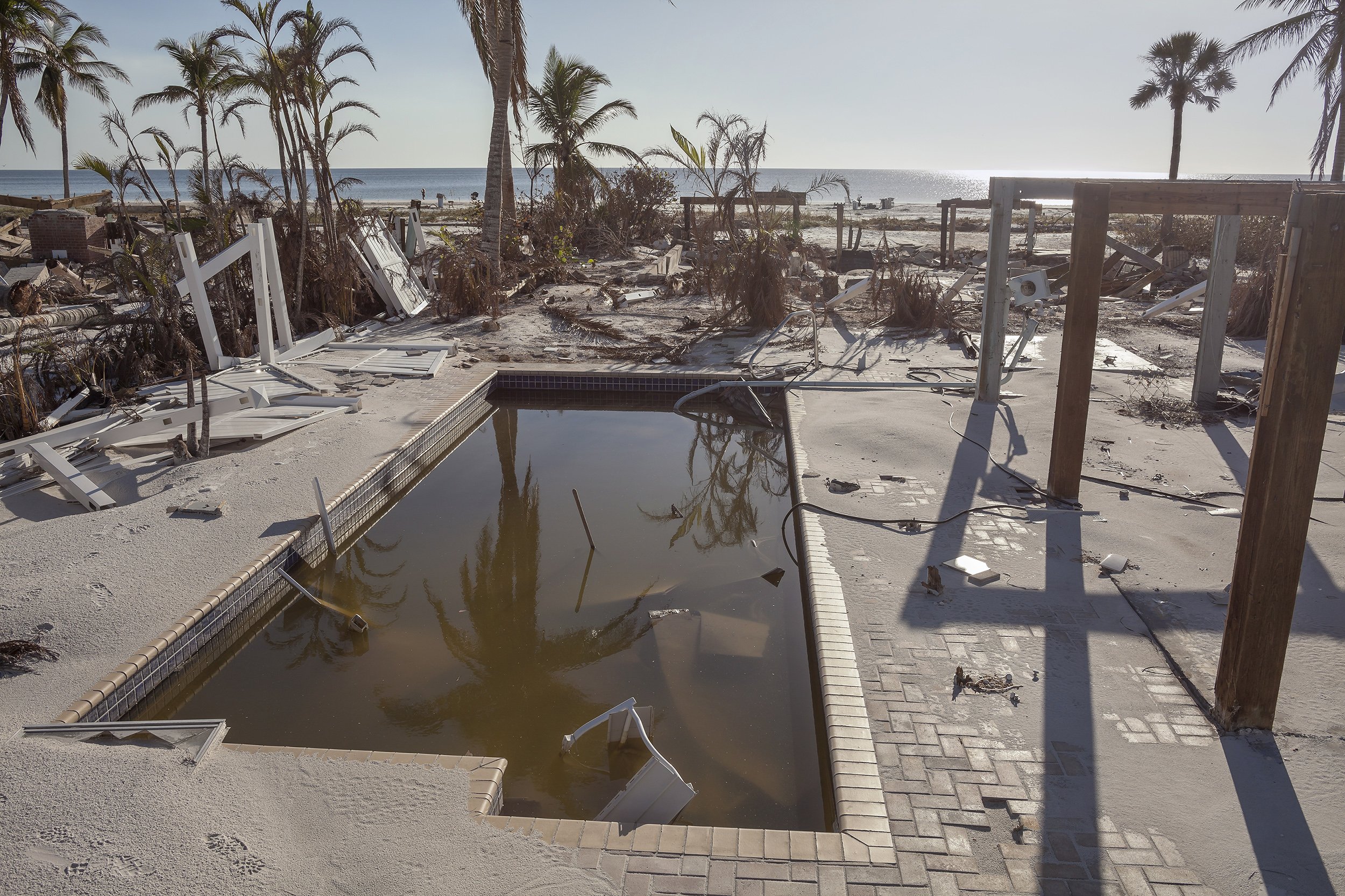
Pool at 3951 W Gulf Dr. after Hurricane Ian, Sanibel, Florida 2023 Elevation Three Feet. N. 26.43406 W 82.11996
4801 Jamacia Dr Sanibel after Hurricane Ian, 2023 Elevation Three Feet N 26.45314 W 82.14189

Site of Sunset Grill and Lazy Flamingo after Hurricane Ian, Sanibel, Florida 2023 Elevation Zero Feet. N. 26.48008 W 82.1825457
House and Debris after Hurricane Ian, Captiva Drive, Captiva, Florida 2023 Elevation Three Feet. N. 26.51610 W 82.19861

Damage from Hurricane Ian, Gulf Star Marina, San Carlos Island, Ft Myers, Florida Elevation Zero Feet, N 26.45908 W 81.95231
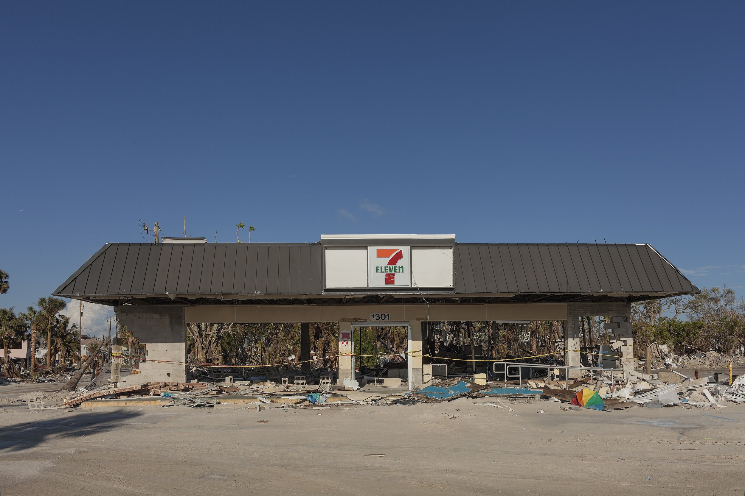
7-Eleven, Ft Myers Beach, Florida, after Ian, 2022 Elevation Seven Feet. N 26.45242 W 81.95211

Mee K Tattoo Studios, Estero Blvd, Ft Myers Beach, Florida, after Ian, 2022 Elevation Three Feet. N. 26.45047 W 81.94797

Estero Island Beach Club Pool Ft Myers Beach, Florida, after Ian, 2022 Elevation Three Feet. N 26.45010 W 81.94836
Floor of a House at 54 Avenue E, after Ian, Ft Myers Beach, Florida 2022 Elevation Three Feet. N. 26.45021 W 81.94961

64 Avenue E, Ft Myers Beach, Florida, after Ian, 2022 Elevation Seven Feet. N 26.45063 W 81.94920
Pool at 5700 Estero Blvd. after Ian Ft Myers Beach, 2022 Elevation Three Feet. N 26.42886 W 81.91230

Ian Beach House Pilings, 93 Sterling Ft Myers Beach, Florida, after Ian, 2022 Elevation Three Feet. N 26.42899 W81.91312

Houses on Palermo Circle after Ian, Ft Myers Beach, Florida, 2022 Elevation Three Feet N 26.45255 W 81.95206

Red Coconut RV Park Sand Dollar Drive after Ian, 2022 Elevation Three Feet N 26.44568 W 81.93591

Wrecked Boats, after Ian, San Carlos Blvd, Ft Myers, Florida, 2022 Elevation Zero Feet. N 26.47049 W 81.95098
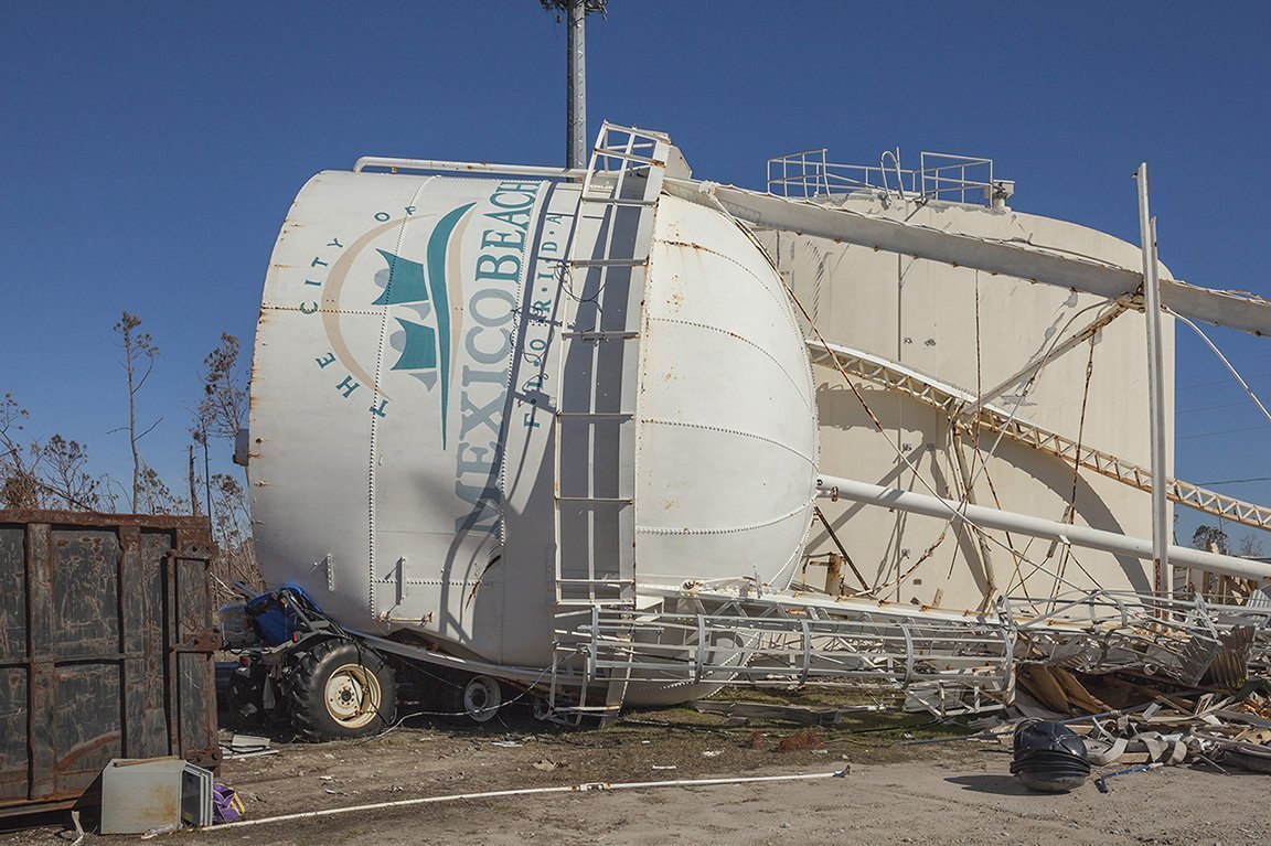
City Water Tower after Hurricane Michael, Mexico Beach, FL 2018 Elevation 7 Feet N 29.94585 W 85.41014

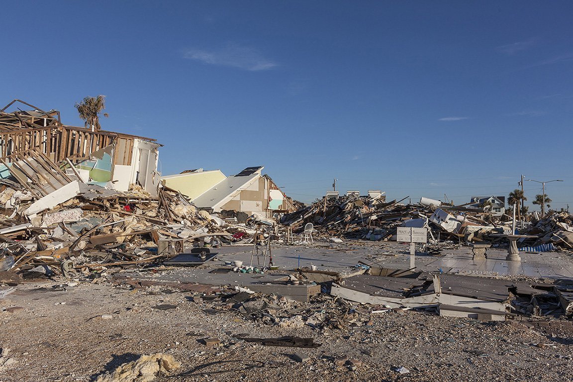
Row of Houses Knocked off Pilings 4106-4102 US Highway 98 Mexico Beach, FL 2018 Elevation 10 Feet N 29.85316 W 85.42585

Shoreline Destruction, South 35th Street, Mexico Beach FL 2018 Elevation 10 Feet N 29.94895 W 85.42251
Pilings Remaining from Two Beach Houses, South 34th Street Mexico Beach FL 2018 Elevation Seven Feet N 29.94869 W 85.42212
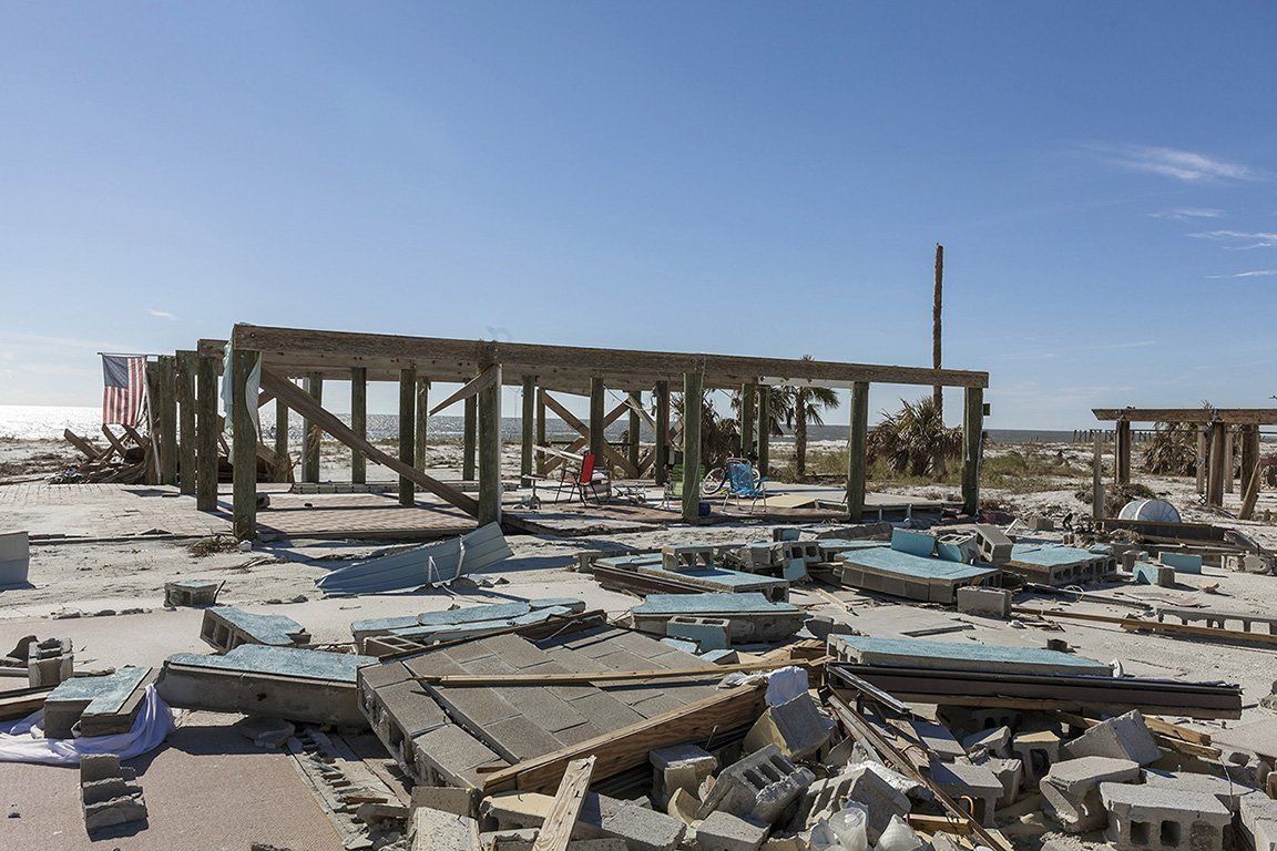
Peace of Paradise” 109 S. 38th St Mexico Beach, FL 2018 Elevation 10 Feet N 29.950446 W 85.424192

Cubes of Crushed Appliances and Metal Mexico Beach, FL 2018 Elevation 10 Feet N 29.95002 W 85.4241

Canal and Debris from Hurricane Michael, Mexico Beach Florida, 2018. Elevation Six Feet. N 29.95331 W 85.42771
Duplex Beach House, One Half Destroyed by Hurricane Michael, 6599 W Highway 98 St Joe Beach, Florida, 2018. Elevation Three Feet. N 29.89608 W 85.36115
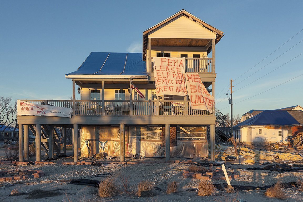
FEMA Help Banner 2014 US Highway 98 Mexico Beach, FL 2018 Elevation 10 Feet N 29.94401 W 85.41201
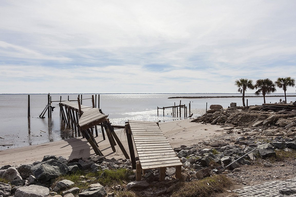
Dock Damaged by Hurricane Michael, Eastpoint Florida, 2018. Elevation Zero Feet. N29.74365 W 84.86596
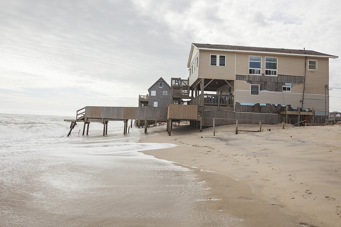
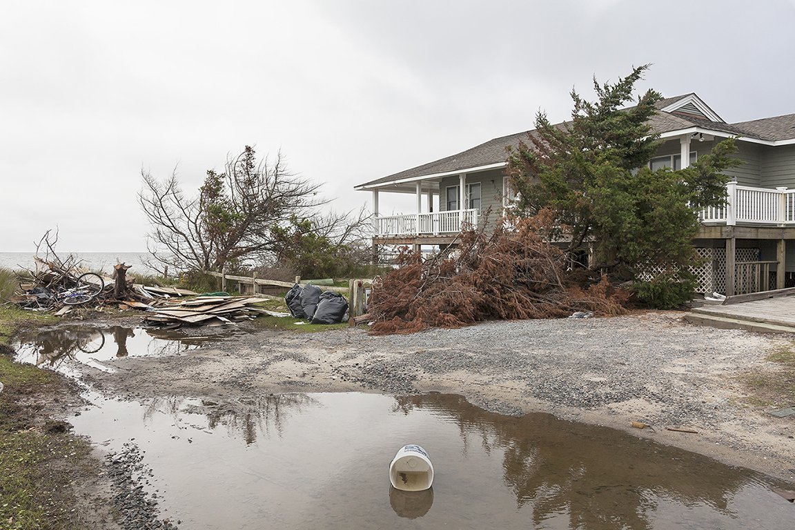
Beach House under Threat and Damaged by Hurricane Dorian, Rodanthe, Outer Banks North Carolina 2019. Elevation Three Feet. N 35.58337 W 75.46154
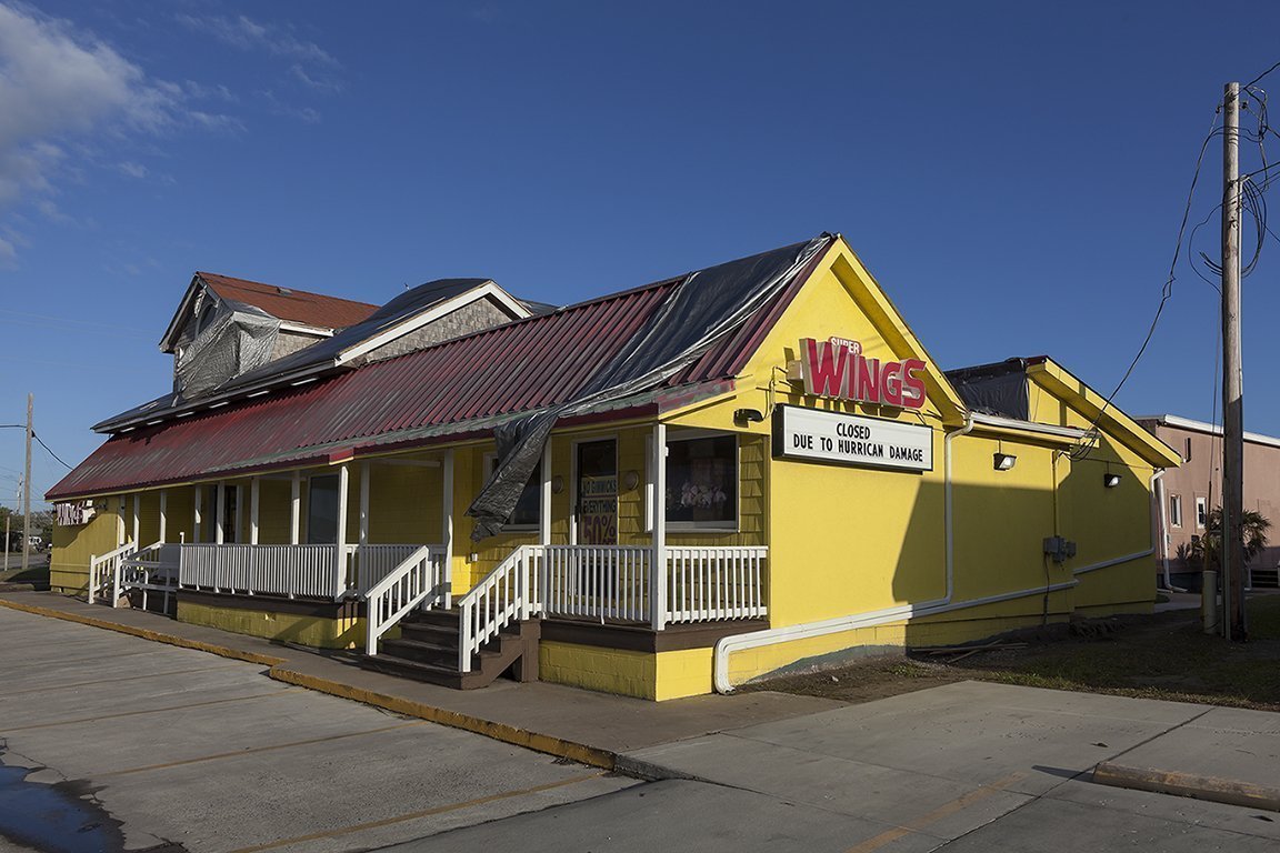
Super Wings Restaurant Closed after Hurricane Dorian, Hatteras, North Carolina, 2019 Elevation Three Feet. N 35.21886 W 75.69385
Beach House Damaged by Hurricane Dorian, 198 Pintail Drive, Ocracoke Island, North Carolina, 2019. Elevation Three Feet. N 35.11757 W 75.97319
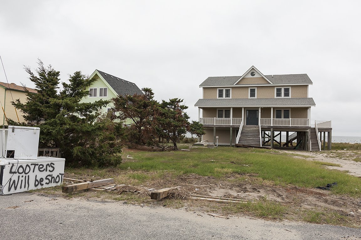
Graffiti Warning after Hurricane Dorian 23 Esham Lane, Ocracoke, North Carolina, 2019 Elevation Zero Feet. N 35.11880 W 75.97360

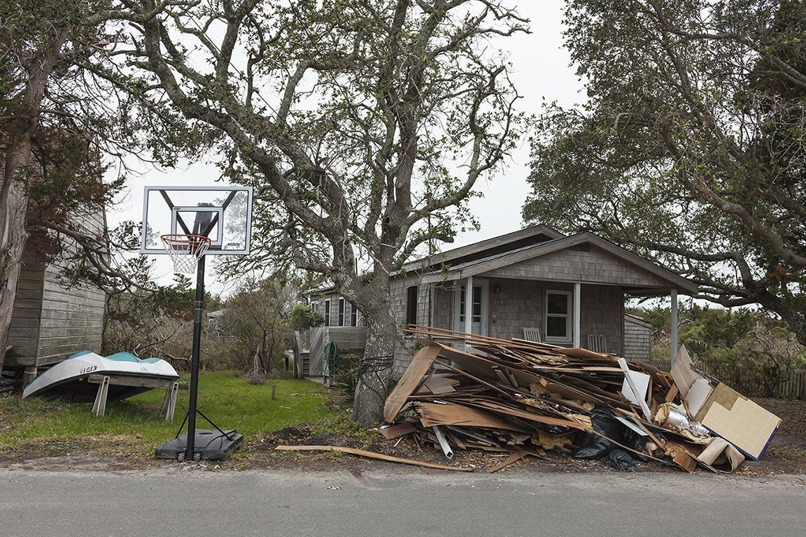
Debris from Hurricane Dorian, Irwin Garrish Highway, Ocracoke, North Carolina, 2019. Elevation Three Feet. N 35.09888 W 75.97092
Debris from Hurricane Dorian, 319 British Cemetery Road, Ocracoke, North Carolina. 2019. Elevation Three Feet. N 35.11837 W 75.98084

Ocracoke Methodist Church Flooded by Hurricane Dorian, Ocracoke, North Carolina, 2019 Elevation Three Feet. N 35.10657 W 75.97919

For Sale after Hurricane Irma, 31569 Avenue D, Big Pine Key, Florida, 2018 Elevation Three Feet. N 24.67169 W 81.34022
. Site of a HGTV “Dream House”, Destroyed by Hurricane Irma, Avenue D, Big Pine Key, Florida 2018 Elevation Six Feet. N 24.6712 W 81.3392
Beach House Totaled by Hurricane Irma, Boulder Drive, Bay Point Key, Florida, 2018 Elevation Six Feet. N 24.62450 W 81.59118
Beach House after Hurricane Sandy 128 B 132 Street, Rockaways, New York 2013 and 2019. Elevation Nine Feet. N 40. 57303 W 73.84914
New Seawall and Damaged House, 136 B144 Street, Rockaways, New York, 2014 and 2019 Elevation Nine Feet. N 40.56934 W 73.85868
Frank Mosznki, President of the Ocean Breeze Neighborhood Association, Who Took the New York Buy-Out Program, Staten Island, New York, 2014 Site with Frank Mosznki’s House Removed, 2019 Elevation Three Feet. N 40.57818 W 74.08208

Site of Ella Norris’s House (She Died in Hurricane Sandy), Buel Avenue, Ocean Breeze, Staten Island, New York, 2014. Re-photographed 2019 Elevation Fifteen Feet. N 40.57847 W 74.08023
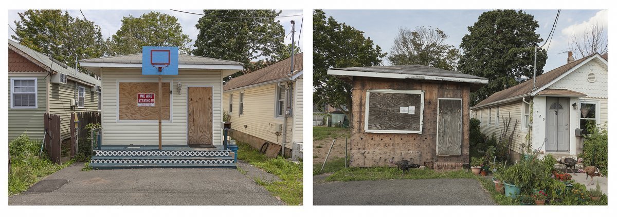
House in a Row of Small Houses, Badly Flooded by Hurricane Sandy, Eventually Took the New York Buy-out Program, Liberty Ave. Ocean Breeze, Staten Island 2013 and 2019. Elevation Fifteen Feet. N 40.57933 W 74.07937

Side Yard of Number Seven Kissam Avenue After Hurricane Sandy Staten Island, New York 2013 House Removed, Site under New York Buy-out Program 2019 Elevation Five Feet. N 40.55711 W 74.11378
Site of 103 Kissam Avenue, Destroyed by Hurricane Sandy, Bought-Out by the City of New York, Staten Island, March 2013 and August 2019. Elevation Three Feet. N 40.55452 W 74.11101
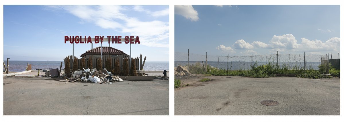
Puglia By The Sea” Sign, Restaurant Destroyed by Hurricane Sandy, Barclay Avenue, Staten Island, New York, 2013. Site Re-photographed 2019 Elevation Four Feet. N 40.52559 W 74.16642
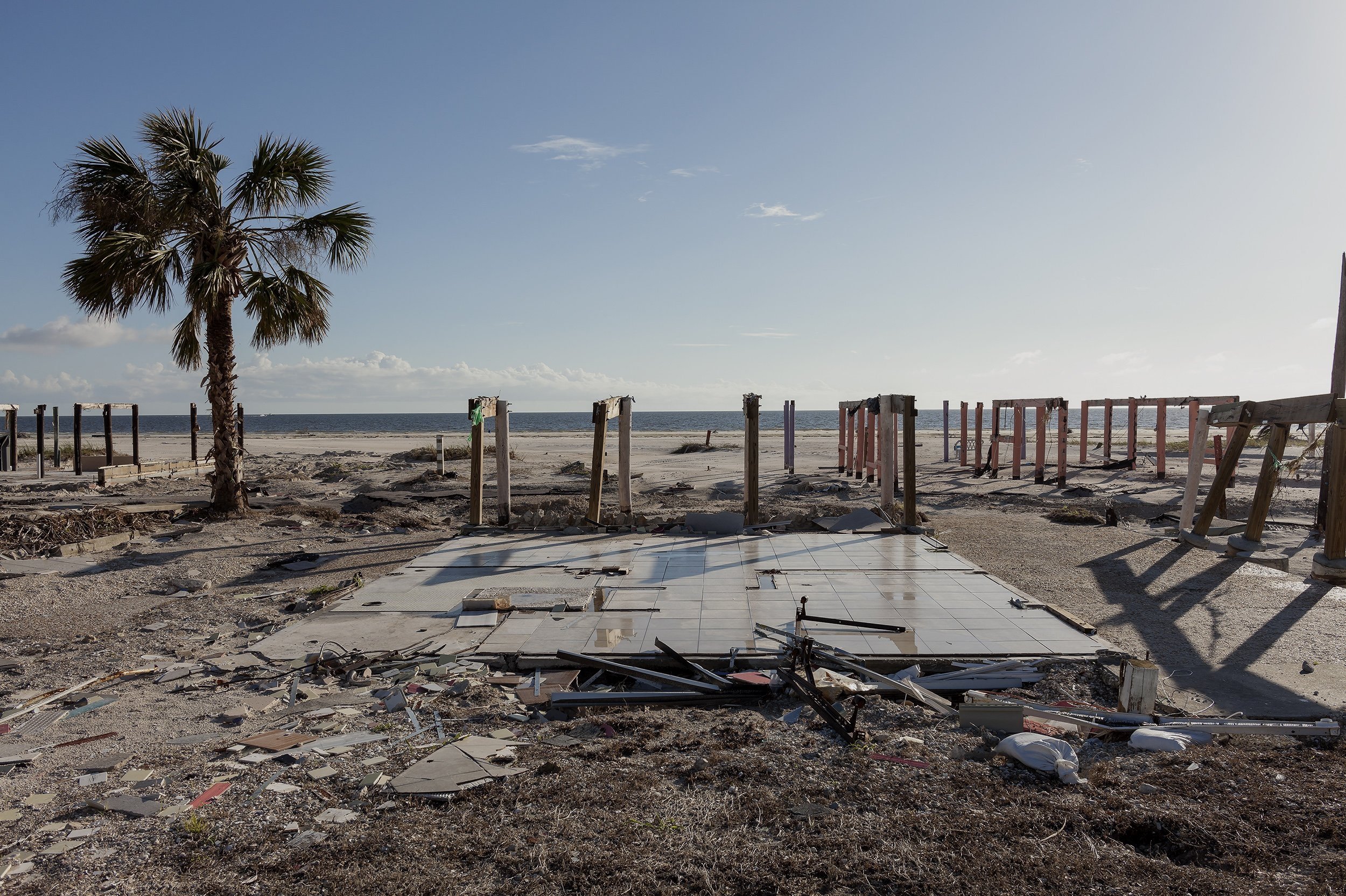
Site of a Beach House on Pilings Destroyed by Hurricane Michael, 2310 US 98 E, Carrabelle, Florida, 2021 Elevation Seven Feet N 29.81185 W 94.72050

“Steamers” Restaurant, 490 Dock St. after Hurricanes Idalia and Helene, Cedar Key, Florida, 2025 N 29.1345 W 83.0312 Elevation Five Feet.

83 Degrees West” Restaurant, 310 Dock St. Closed after Hurricane Helene, Cedar Key, Florida, 2025, N 29.1349 W 83.0305 Elevation Four Feet
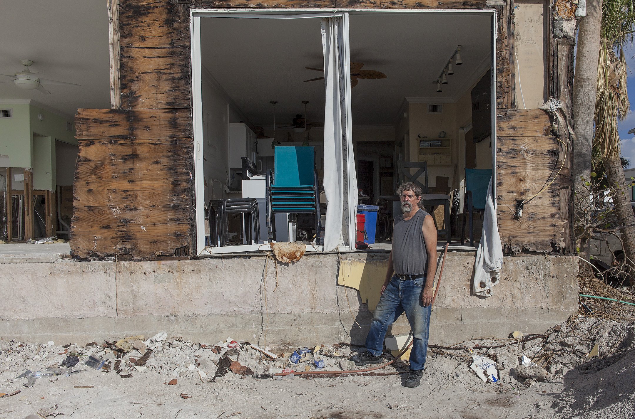
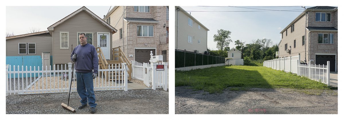
Ron in Front of His Condo, Condemned after Hurricane Milton, 210 Gulf Drive North, Bradenton Beach Florida 2024 N 27.4709 W 82.7005 Elevation Three Feet
The Endangered Coast
The Future Is Now
Climate change has been scientifically proven and is here and now. It portends a bleak future for humankind and is a global crisis of great urgency that, thankfully and at last, was acknowledged by the international community at the Paris accord on climate of December 2015. This book is my response to this phenomenon.
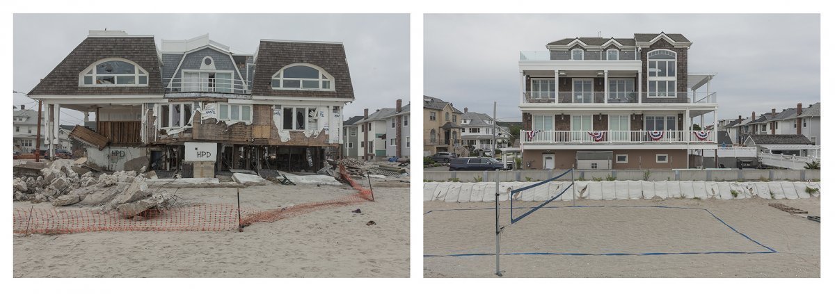
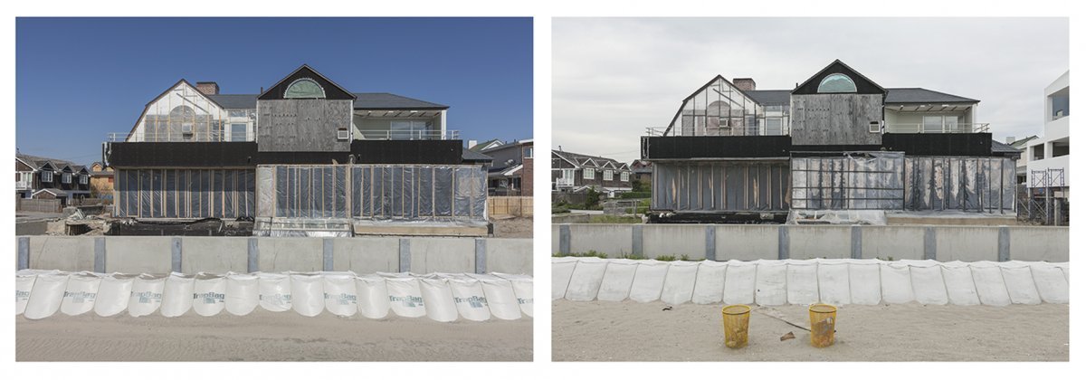
For this project, my photographic approach was to document sites along the Gulf and Atlantic Coasts so low in elevation that they will be severely affected by rising sea levels and storm surges. I have photographed these coastal areas as they are today, in their seemly normal “business as usual” state. I also photographed sites affected by big coastal storms such as the Hurricane of 1933 and Hurricanes Rita and Katrina in 2005, Gustav and Ike in 2008, Irene in 2011, Sandy in 2012, and Arthur in 2014. Being so close to the water, these sites of storm damage are at an elevation that makes them vulnerable to high tides, storm surges, and hurricanes. These storms are now more frequent and severe because of global warming in the oceans and atmosphere. In 2014, I revisited sites I had previously photographed in 2010 and 2013 to show the changes during the slow recovery from these brutal storms. For all photographs in the book, I record the exact locations with GPS coordinates and elevations above sea level to emphasize the specificity and fragility of these environments. In the future, these sites may be revisited by anyone tosee the ongoing changes that are sure to come as sea levels rise.
The current effects of high tides, storm surges, and hurricanes on low-lying coastal areas (essentially any elevation less than fifteen feet) give us a glimpse into the future in which these same areas will be frequently under attack or completely destroyed as seas continue to rise and storms intensify. The most recent IPCC (Inter-governmental Panel on Climate Change) estimates for sea levels a century from now predict a rise of 3.3 feet (1.006 meters) as a virtual certainty, with a plausible range much higher, according to recent scientific research by Dr. James Hansen and others. A five-foot (1.524-meter) rise would submerge 22,000 square miles (56,980 square kilometers) of U.S. Coastline on the Atlantic and Gulf Coasts alone. All the other coastal areas of the world will, of course, share this fate, since the vast majority of people live in coastal regions. After the 100-year mark, seas will continue to rise, as the effects of global warming will continue and even spiral completely out of control, if action from the Paris accord fails to meet the minimum prescribed goals for an increase in the world’s atmospheric temperature. To that end, there may still be time to stabilize the global climate, if and only if the current “business as usual” patterns of human activity are changed in the near future.
My photographs show the unsustainable and seemingly endless development of barrier islands and other fragile and low-lying coastal environments. They underscore the absurdity of our current state of denial, when it comes to climate change and sea-rise.